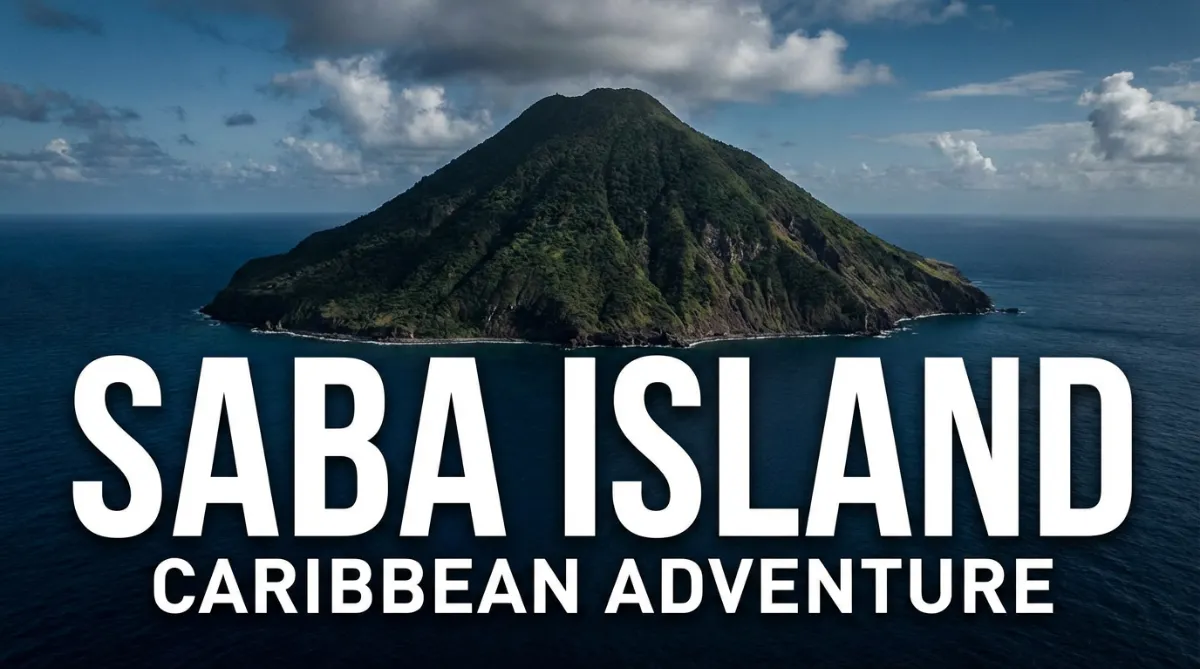
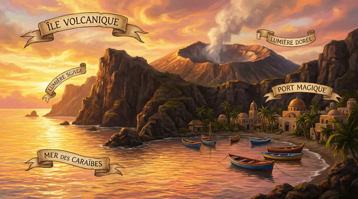
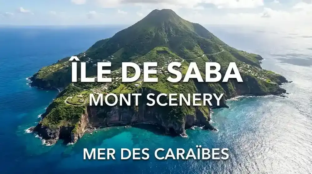
Saba island is a volcanic rock rising straight from the sea, 28 miles southwest of St. Maarten. About 2,000 people live here across four villages. No beaches, no cruise ships, no casinos. What you get instead: some of the Caribbean's best diving, hiking trails climbing 2,910 feet to Mount Scenery's summit, and a quiet that's hard to find anywhere else.
Skip the crowded Caribbean resorts. Saba island is a volcanic rock rising straight from the sea, 28 miles southwest of St. Maarten. About 2,000 people live here across four villages. No beaches, no cruise ships, no casinos. What you get instead: some of the Caribbean's best diving, hiking trails climbing 2,910 feet to Mount Scenery's summit, and a quiet that's hard to find anywhere else.
What Makes Saba Different from Every Other Caribbean Island
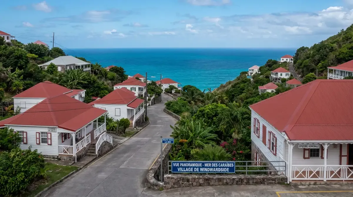
Saba is the outlier. This 5-square-mile volcanic cone in the Dutch Caribbean looks nothing like the brochure version of the islands. No white sand beaches. No palm-lined shores. Instead, steep green cliffs drop straight into deep blue water, and a single road snakes up the mountainside to villages perched on impossible terrain.
The island sits in the Leeward Islands chain, grouped with Sint Maarten and Sint Eustatius as part of the Netherlands. But the vibe here has nothing to do with Europe. Life on Saba moves at its own pace. The Saban people have kept development out for decades, partly by choice and partly because the geography makes building anything difficult. The result: one of the most unspoiled spots left in the Caribbean.
Dutch colonists arrived in the 1600s, and the island passed through various hands before landing back with the Netherlands. Today, Saba is a special municipality. English is the main language spoken on Saba island, though Dutch shows up on official paperwork. Most visitors come from the United States, and they don't have trouble communicating.
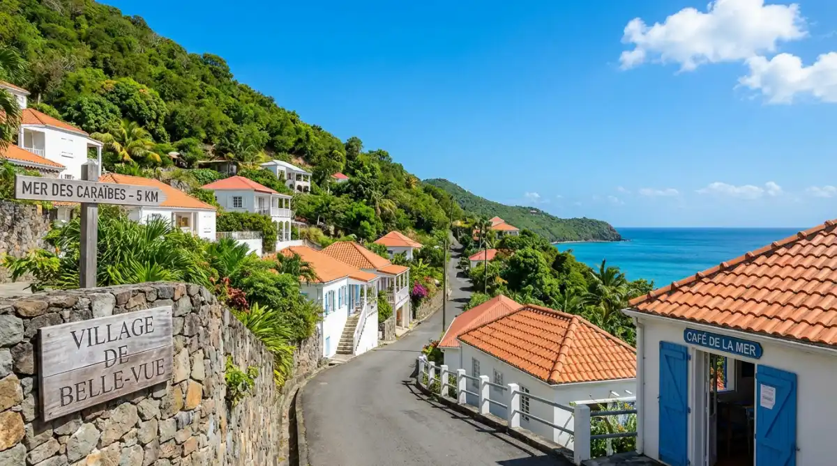
Does anyone live on Saba island? Yes. Around 2,000 residents spread across four villages: The Bottom (capital), Windwardside, St. John's, and Hell's Gate. There's no traffic lights, no McDonald's, no shopping mall. Neighbors actually know each other. Kids walk to school. It feels like the Caribbean of 50 years ago, before mass tourism changed everything.
How to Get to Saba
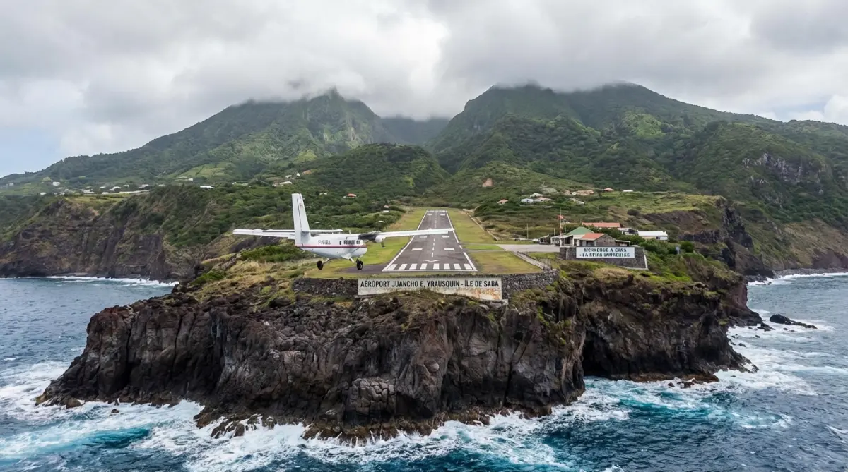
How do you get to Saba island? This trips up first-time visitors. The island has Juancho E. Yrausquin Airport, which holds the record for one of the world's shortest commercial runways at about 400 meters. Planes land between two cliff edges. It looks terrifying from the window, and honestly, it is. But the pilots who fly here train specifically for this strip.
Winair runs daily flights from Sint Maarten's Princess Juliana International Airport. The flight takes 15 minutes. Book in advance during high season because these small planes fill up fast.
The Makana ferry offers another way in. It departs from Sint Maarten several days a week and crosses in roughly 90 minutes. The open sea can get choppy, so take seasickness pills if you're prone to it. On clear days, you'll pass Sint Eustatius and spot St. Kitts and Nevis in the distance. Dolphins sometimes swim alongside the boat.
Both routes drop you into Saba's single transportation system: The Road. This engineering project, completed in 1958, connects Fort Bay harbor to the airport and winds through every village. Local taxis wait at both arrival points. Twenty minutes gets you anywhere on the island.
Diving Saba: Why Divers Keep Coming Back
The Saba Marine Park wraps around the entire island. Established in 1987, it's one of the oldest marine protected areas in the Caribbean, and the protection shows. Visibility hits 100 feet regularly. The reefs are healthy. Sharks cruise by. Sea turtles aren't rare sightings; they're Tuesday.
The Pinnacles draw experienced divers from around the world. These underwater volcanic mountains rise from 300+ feet depth to within 90 feet of the surface. Schools of fish swirl around the formations. Sites like Third Encounter and Twilight Zone drop into deeper water where the marine life gets stranger and more diverse.
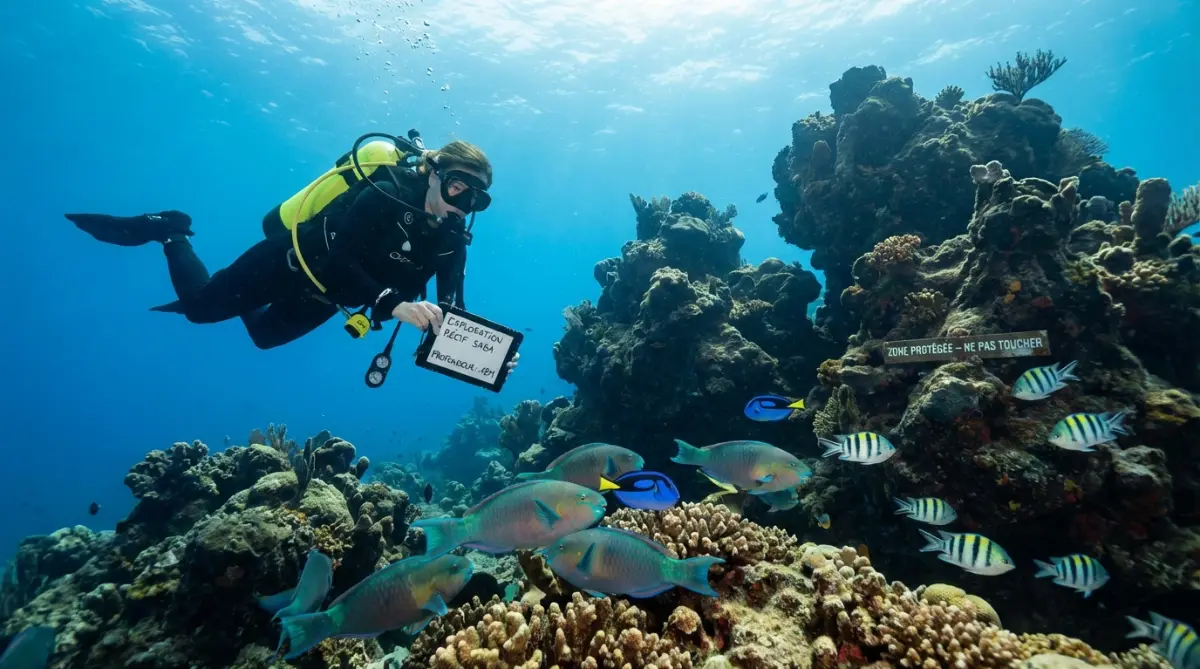
Five dive centers operate on the island, and they all offer courses for beginners alongside guided dives for the experienced. Snorkeling works too, especially around Fort Bay and Wells Bay where the water stays calm. You won't see the deep stuff without scuba gear, but the shallow reefs have plenty going on.
Fort Bay also launches fishing trips and boat tours. Local operators take people around the island's coastline to see the sea caves and bird colonies. The volcanic cliffs look even more impressive from the water level.
Hiking Mount Scenery and the Cloud Forest
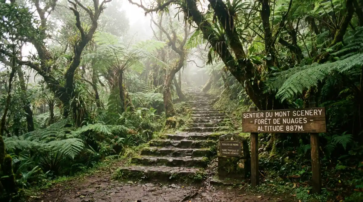
Mount Scenery tops out at 2,910 feet. Here's a strange fact: that makes it the highest point in the entire Kingdom of the Netherlands. Higher than anything in the Netherlands itself, and it's sitting in the Caribbean. The main trail starts in Windwardside. Most people need about two hours to reach the summit.
The hike starts through secondary forest and then climbs into cloud forest. The scenery shifts completely. Mist moves through mahogany trees. Ferns cover the ground. Orchids hang from branches. Birds you won't see anywhere else in the region fly through the canopy, including the bridled quail-dove, which only lives on a few islands.
Other trails criss-cross the island. The Crispeen Track links The Bottom and Windwardside through green hillsides. Sandy Cruz Trail leads to tide pools and ocean views. The Sulphur Mine Trail passes steaming volcanic vents. The dormant volcano beneath Saba hasn't erupted in recorded history, but the hot springs and sulfur deposits remind you it's still there.
The trails get slippery after rain, and rain happens frequently at higher elevations. Start early. Afternoon clouds often roll in and block the summit views. Local guides know the trails well and tell good stories about the island's history.
Hotels and Restaurants on Saba
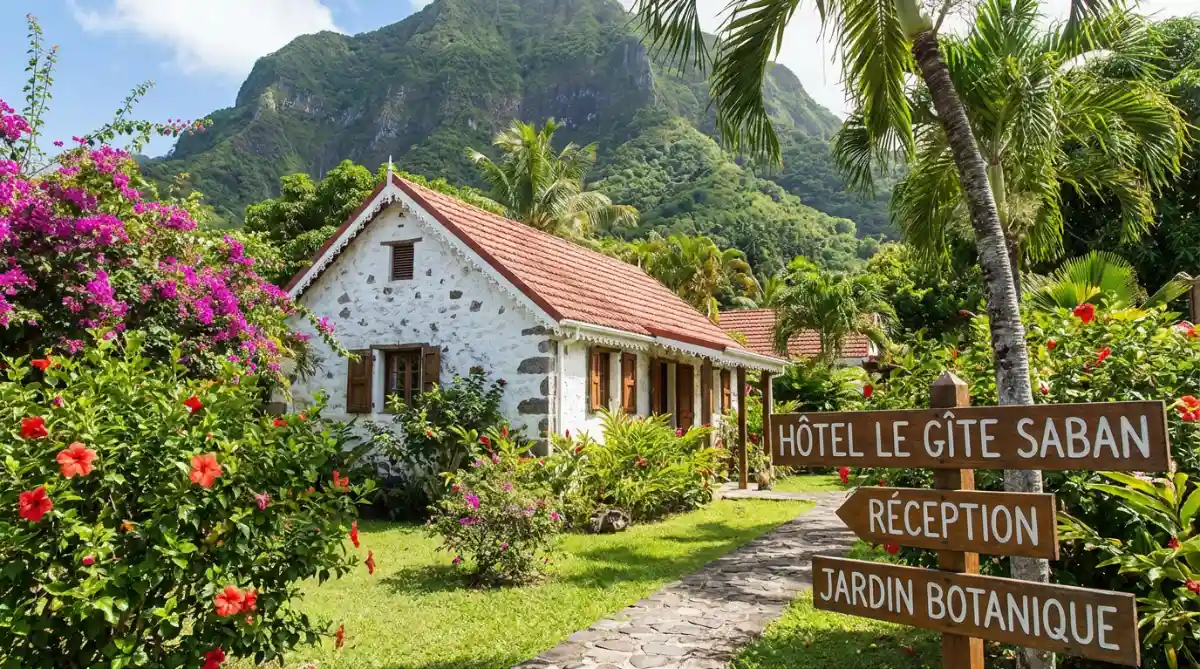
Saba has boutique hotels and cottages, not resorts. The island's too small for mega-properties, and that's the point. Most accommodations sit in Windwardside or The Bottom. Windwardside puts you near hiking trails and restaurants. The Bottom offers even more quiet.
Several hotels occupy traditional Saban cottages. These buildings have white walls and red or green roofs. The construction technique, using wooden joints instead of nails, dates back over a century. Craftsmen still know how to repair them. Staying in one connects you to the island's history in a way modern hotels can't.
Restaurant options are limited. A handful of places across the island serve seafood and Caribbean-international fusion. Make reservations during high season. The fish comes from local fishermen and the vegetables often grow in island gardens. The volcanic soil produces good food.
If you're staying in a self-catering cottage, stock up on groceries in Sint Maarten before coming over. The general stores in The Bottom and Windwardside carry basics, but inventory depends on when the supply boats arrive.
Practical Details Before You Go
What language is spoken in Saba island? English. Dutch is officially recognized because of the Netherlands connection, but everyday conversation happens in English. You'll see Dutch on government forms and some signs.
The currency is US dollars. Credit cards work at most hotels and restaurants. Bring some cash for tips, small shops, and places without card readers.
Temperatures stay between 75°F and 85°F at sea level year-round. Higher up on Mount Scenery, it cools down. Sometimes into the 60s. Pack layers if you plan to hike. Rain can hit any time of year, but the wet season runs August through November.
What movie was filmed on Saba island? The 1958 film "The Old Man and the Sea" with Spencer Tracy shot several coastal scenes here. Filmmakers and photographers still come for the same reason: the landscape looks unlike anywhere else.
Healthcare on Saba means a small hospital in The Bottom. Anything serious requires evacuation to Sint Maarten. Get travel insurance that covers medical evacuation. This matters on remote islands.
Getting Around the Four Villages
The Road deserves its capital letters. Experts said you couldn't build a road on Saba. The terrain was too steep, too volcanic, too impossible. Then Josephus Lambert Hassell, a local man, took a correspondence course in engineering and spent years proving them wrong. The Road opened in 1958 and remains the only way to drive around the island.
Rental cars exist but aren't necessary. Taxis get you anywhere in minutes. Walking works for short distances, though the hills make it harder than you'd expect. Plan routes based on your fitness.
Windwardside is the main village for tourists. Most hotels, restaurants, and shops sit here, at about 1,600 feet elevation. The weekly market sells local goods. Small museums cover the island's history.
The Bottom, despite the name, sits in a valley 800 feet up. It's the capital, so government offices, the church, and the hospital are here. The architecture shows off Saban cottages at their best. A botanical garden displays local plants.
Day Trips and Island Hopping
Saba works as a multi-day destination or a day trip from Sint Maarten. The two islands sit 28 miles apart but feel like different planets. Sint Maarten has crowded beaches, casinos, cruise ships, international restaurants. Saba has none of that.
Sint Eustatius lies 17 miles southeast. Locals call it "Statia." It shares Saba's quiet character but has its own history and dive sites. Day trips between the islands are possible, but most people give each island separate time.
For those chartering boats from our Caribbean destinations, Saba makes an incredible stop. Approaching by sea shows the island's full scale. The volcanic cone rises sharply from deep water. Fort Bay harbor is carved from rock. The switchback road climbs the cliff face.
Yacht visitors anchor off Fort Bay and tender to shore. From there, you can arrange a tour, hike one of the trails, or just eat lunch at a local restaurant. The crossing from St. Maarten takes 3-4 hours depending on conditions. You'll pass Sint Eustatius along the way.
When to Plan Your Trip
High season runs mid-December through April. Northern Hemisphere visitors escape winter. Flights and hotels fill up. Book weeks or months ahead during these months.
Shoulder seasons in May-June and November have fewer crowds and better deals. Diving visibility often peaks between April and November when the sea stays calmer.
September and October bring the highest hurricane risk. Saba's remote location and mountainous terrain offer some natural protection, but weather can still disrupt travel plans. If flexibility matters, avoid these months.
Saba Summer Festival happens in late July with music, parades, and local gatherings. Carnival runs in February or early March. The usually quiet streets fill with costumes and dancing.
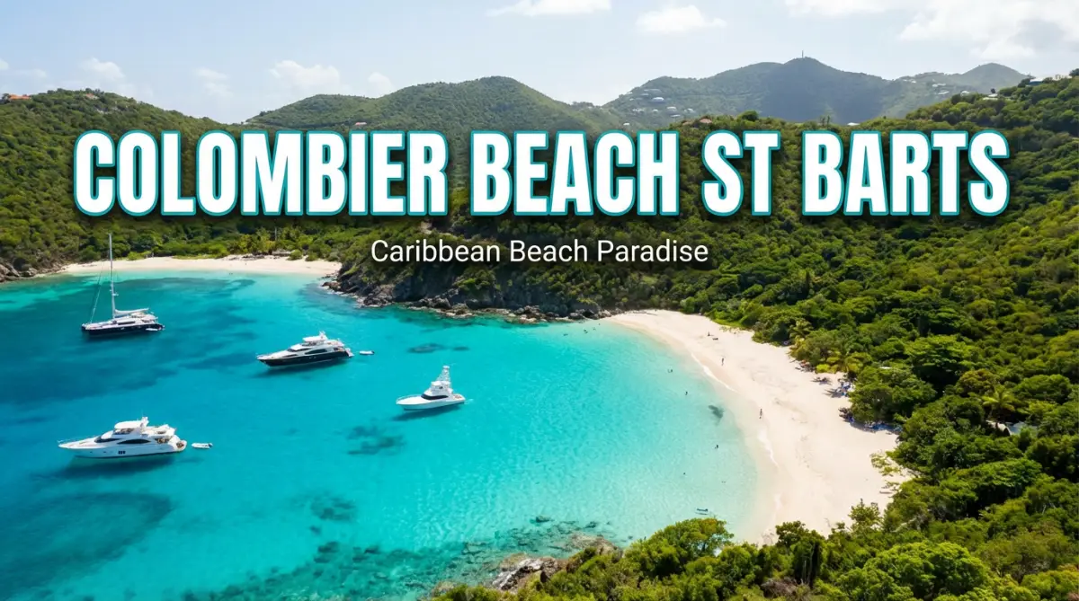
Prices drop noticeably during low season. Even during peak times, Saba costs less than St. Barths or the British Virgin Islands. The island never got the luxury resort treatment that inflates prices elsewhere.
The Honest Truth About Saba
Saba works for a specific kind of traveler. If you want beach clubs, nightlife, or extensive shopping, this isn't your island. If you want quiet, natural beauty, and a Caribbean that hasn't been polished for mass tourism, Saba delivers.
The access is difficult on purpose. That short runway and the ferry ride across open water keep the crowds away. Saban residents decided years ago to build around eco-tourism rather than fight against their geography. The marine park protects healthy reefs. The trails stay pristine. The villages preserve architecture from centuries ago.
About 2,000 people live here, and they actually talk to each other. Visitors get real welcomes, not hospitality scripts. The sea surrounds everything. The volcano rises overhead. The world outside fades somewhere across the water.
Getting to Saba takes effort. So does hiking the trails and diving the deeper sites. But people who make the trip keep coming back, or at least keep talking about it. There's something here that's getting harder to find: a place that hasn't changed to meet tourist expectations.
Stay Updated with Funseaker News
Don't miss the latest updates from Caribbean yacht charter industry and Funseaker fleet news